


FLASH NEWS
From Spain to Greece and Albania, the entire Mediterranean is burning, NASA publishes satellite images

2025-07-26 22:43:00 / AKTUALITET
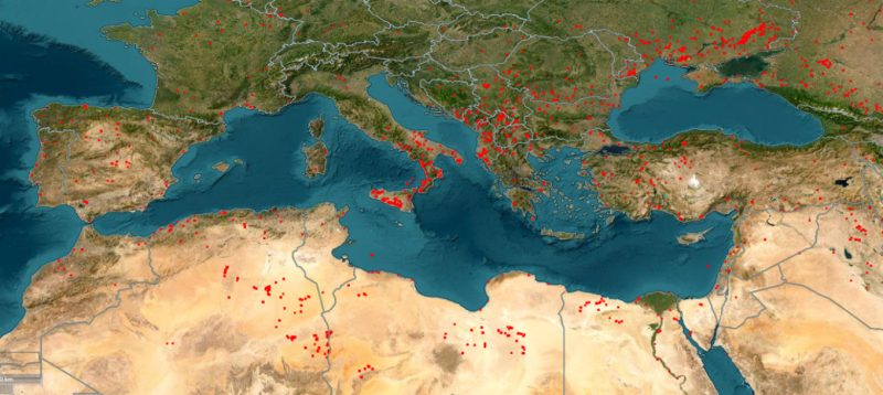
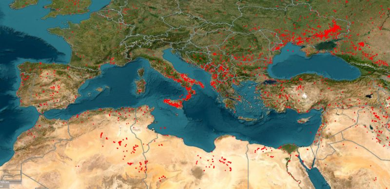
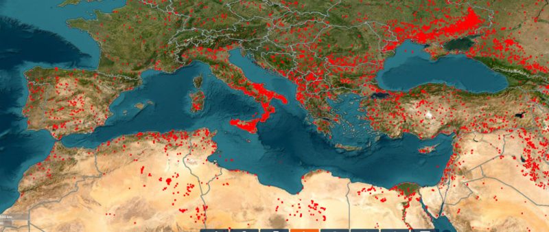
NASA's satellite system has captured clear images of wildfires that have spread across the Mediterranean. From Greece to Spain, from southern France to Cyprus, from Italy to Albania, hundreds of active fires are burning forests and large areas of green space.
Each red dot in the satellite images represents an active fire, whether large or small. The images show the development of fires over time, those that are active today, those recorded in the last 24 hours, and those that have occurred over the last 7 days.
For the past week in particular, the data shows a wide spread of fires, as it was one of the hottest of the summer. The Balkan countries and Italy have been hit by a heat wave, favoring the spread of the flames. Most of the red dots on the map represent fires in forest areas.
However, some of the spots could also indicate human activity, such as factories, controlled burning by farmers in fields, or even explosions related to the war in Ukraine.
Happening now...


America may withdraw from Europe, but not from SPAK
Nga Gentian Gaba
ideas


top


Alfa recipes


TRENDING 


services
- POLICE129
- STREET POLICE126
- AMBULANCE112
- FIREFIGHTER128